I love trying to figure out the age of old maps. If there’s a globe in someone’s house, or if I find an old map in a thrift store, I look for clues—the existence of the Soviet Union, if Germany is divided into East and West, or whether Nunavut is a separate territory of Canada. I’m very fun at parties.
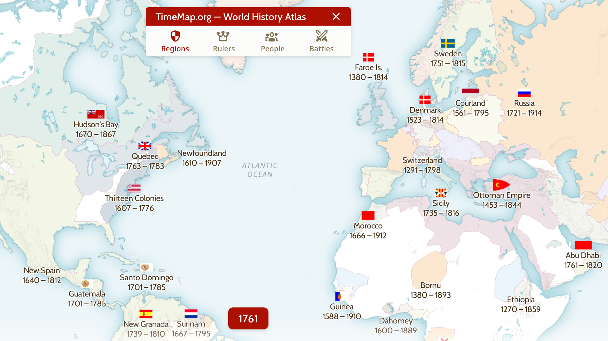
Nothing on the internet has given me that same feeling quite like Old Maps Online, which is one of the coolest websites I’ve found in a while. The interface looks simple at first: It’s just a world map with a slider you can move to see the borders at different times in history. It’s like Google Maps for history—you can set a year and see borders as they were at the time. You can even click the name of any country or territory you don’t recognize to read a Wikipedia article about it in the sidebar.
You can just play with this—look at any region of the world and move the slider, just to see how the borders evolved over time, then click any country, empire, or territory you didn’t know about. Things get really interesting if you look over a region you think you know well. Sliding the dial through history can teach you just how much borders have changed over time and keep changing even today. Europe looks pretty different now than it did in the early 1990s.
But you’re not limited to just looking at a modern projection of where borders once were. You can also see maps made at the time, overlaid right over the one you’re looking at.
This gives you an idea of how people who were alive at the time were thinking about the borders. There is a surprising abundance of old maps you can explore, and you can even set transparency to see the old map in context. Honestly, I could play with this for hours—and have. There’s everything from old sea charts to tourist guides from the 1950s, and users are adding more maps all the time.
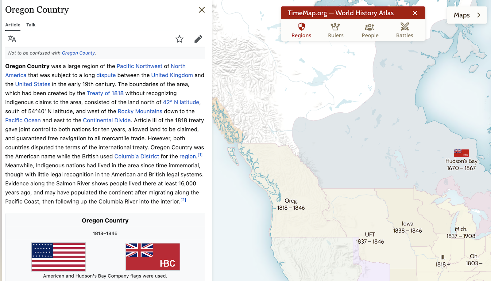
You can learn all kinds of things by clicking around on this site. For example: Did you know that the Pacific Northwest states of Oregon and Washington, along with the Canadian province of British Columbia, were co-governed by the British and American governments for almost 30 years?
Old Maps Online can also provide some useful cultural context if you’re considering international travel, especially if you click through to articles. I, for example, traveled to Croatia last year, and I learned a lot before the trip by scrolling back in time while looking at a map of the country and clicking articles.
It’s more than a cool website—it’s an easy entry point into learning history. Scroll back on any area of the world and you’re sure to notice a few things you didn’t know. After that you can head to the library and dig in even deeper.